North Alabama Weather Shift Brings Cooler Nights and Rain Chances to Sheffield Area
The people in the Sheffield community, Franklin County, are in the middle of North Alabama, where there has been a noticeable change in weather patterns as winter approaches. By January 18, 2026, the area had been hit by a surge of colder air, which had dropped temperatures well below seasonal averages and raised the potential for precipitation in the next few days.
This has been a shift following a comparatively light start to the month, and it has surprised many locals, forcing them to make changes in their daily lives. According to meteorologists, this change is due to cold fronts that have swept southwards, bringing Arctic air, which is very different from the warm weather experienced in the same week.
Sheffield Conditions as of Today
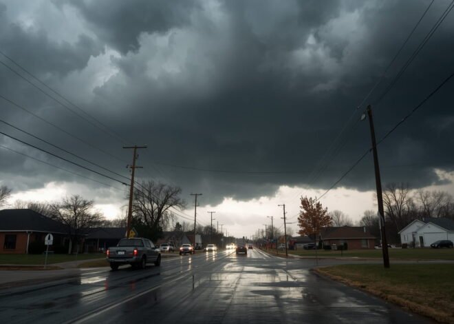
The change in the weather in Sheffield today is a manifestation of the sudden shift towards cooler weather. The heat is failing to reach the high 30s, and the expected peak is about 37 to 38 degrees F, with partly sunny skies. This is a stark contrast to the average January temperature of around 51 degrees, and the air is especially crisp for outdoor activities.
Minimum temperatures are dropping into the low 20s, in the 21-degree range, which might result in frosty mornings and the possibility of ice on untreated surfaces. There are northwest winds of 10 miles per hour, further increasing the chill, and the wind chill could be as low as the upper 20s during the day and perhaps even lower at night.
This cold snap followed a slight icy mix that occurred early on January 17. The weather was in the mid-40s range with scattered precipitation. This occurrence marked the start of the transition and was the result of moisture from a moving front mixing with the incoming cold air.
Although there was no major build-up, it was an indicator of changing winter conditions in North Alabama. The same condition is being reported in other surrounding regions, such as Muscle Shoals and Tuscumbia, with clear skies being the way to go, though there is a definite crispness in the air.
Forecast for the Coming Days
In the future, the weather forecast predicts that these lower temperatures will continue until mid-week, and then moderate gradually towards the weekend. On January 19, the forecast is partly cloudy, with highs in the low 40s and lows once more in the low 20s. The threat of frost remains very high, and gardeners and farmers are encouraged to cover vulnerable plants. Possibly, a slight warming pattern will occur by January 20, with highs around 45 degrees, but nights will remain cold.
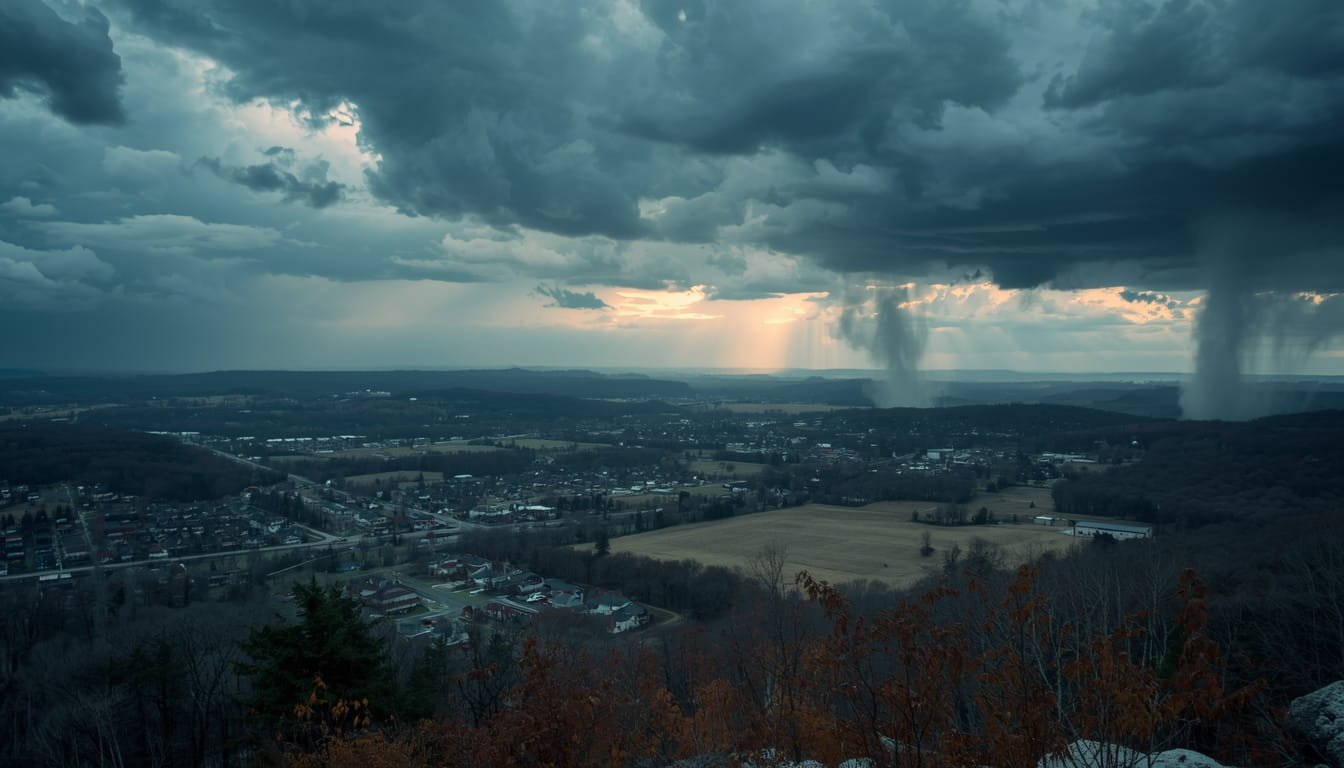
Later in the week, rain risks start to go up, especially after the 22 nd of January. Scattered showers could occur in Sheffield due to a low-pressure system forming in the Gulf of Mexico. The chance of rain is approximately 40 per cent from January 25 to 28, with possible greater downpours in southern Franklin County.
This might be as much as a half an inch of precipitation, which would be useful for replenishing the area’s water tables but could cause slick roads if temperatures are near freezing. The lower temperatures and incoming moisture increase the likelihood of mixed precipitation, though current models suggest liquid rain is more likely than snow or ice at lower elevations, such as Sheffield.
Long-term projections from agencies such as the National Weather Service suggest that this change is not an isolated event but rather an extension of a general trend triggered by La Nina conditions, which tend to make winters in the southeastern United States both wetter and colder. The rest of January could be up to 5-10 degrees below normal, with occasional rain interspersed with otherwise dry periods.
Effects on Local Communities
The change in weather is already affecting the day-to-day life in Sheffield and the Franklin County neighbourhood. Local schools are keeping a close eye on things, and there may be delays if icy spots form on the roads due to low temperatures overnight.
Driving authorities have issued warnings to urge drivers to be careful, particularly on bridges and overpasses where freezing is more likely. The Alabama Department of Transportation has already deployed salt trucks to the area to treat any slick spots that may form.
The less favourable nights are a problem for agriculture, an industry of the local economy. The growers of winter-grown crops like wheat and cover crops worry about frost damage, and some use protective measures such as row covers. Livestock owners are also ensuring their animals have proper shelter and warm water points to avoid cold-related health problems. Positively, the anticipated rain might alleviate the dry soil conditions that persisted until early January, which helped with spring planting preparations.
People are getting used to it by going outside to wrap up for shopping trips and changing heating controls. Energy companies report an upsurge in consumption as thermostats are set high to fight the cold. The warming stations at community centres in Sheffield are available to vulnerable populations, such as the elderly and homeless, to take a break from the cold. There is a lot of foot traffic to these local businesses, whether coffee shops or hardware stores, with hot drinks and winter-related products such as de-icers and blankets.
Preparation and Safety Tips
With more bouts of cooler nights and the appearance of rain in the region, professionals note that people need to be prepared. The homeowner is supposed to insulate pipes to prevent them from bursting during sub-freezing weather and test the heating system’s efficiency.
For outdoor ventures, particularly when going out, it is important to wear multiple layers of clothing, hats and gloves to retain body heat. Motorists are encouraged to maintain a safe distance on roads that may be wet or icy, and to carry emergency kits in their vehicles, such as blankets, flashlights, and non-perishable snacks.
Health officers encourage people to recognise the symptoms of hypothermia, such as shivering, confusion, and slow breathing, especially when they are kept in the cold for too long. Risk mitigation can be achieved by staying hydrated and avoiding prolonged exposure to the peak chill hours. In the case of the next rain, minor flooding in the low-lying parts of Franklin County can be prevented by guaranteeing adequate drainage around houses.
Broader Regional Context
This climatic change is not confined to Sheffield alone; a good part of North Alabama has been affected by these influences. The temperatures in Huntsville, a little north of Sheffield, are following suit, though there might be some flurries in higher elevations.
Warmer influences could occur in Birmingham to the south, and it can be expected that the highest temperatures will be around 40s, and the probability of precipitation will also be very similar. Topography is also a major factor in the exaggerated effects of cold fronts in the Tennessee Valley region, including Franklin County, where valleys can trap cooler air.
Climate patterns suggest these changes may become more common, with winters exhibiting greater variability. Though this incident causes some discomfort, it also highlights how the communities of North Alabama have had to endure the whims of the southern winter over time. In the latter half of the week, I will find it essential to keep track of the local forecasts to manage the colder evenings and even rainfall.
In short, the current weather change in the Sheffield region is an indicator of a shift toward a more classic winter atmosphere, with cooler seasons prevailing and rain expected in the future. This transition, though difficult, will provide the community with an opportunity to unite and prepare for it, so that it is safe and life is not disrupted much.
Related Posts

Iowa Public Safety Update: State Officials Introduce New Road Safety and Emergency Response Measures

Iowa Gas Prices Drop Ahead of the Weekend: What Drivers Need to Know Today