US News
Cold front could spark dry lightning and wildfire spread across West
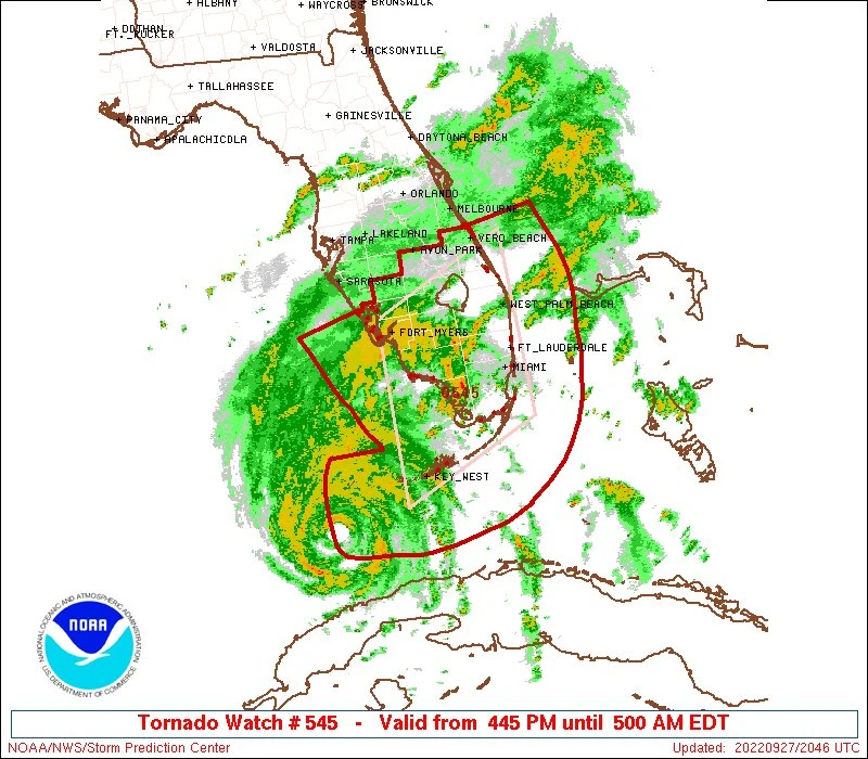
The National Weather Service Storm Prediction Center issued a Day 2 fire weather outlook on Tuesday, June 23, flagging a critical fire weather area for central and western Utah. A colder air mass is expected to develop over the Pacific Northwest on Thursday, June 25, then push southeast into the Intermountain West, where the leading edge of the system could produce dry lightning instead of soaking rain.
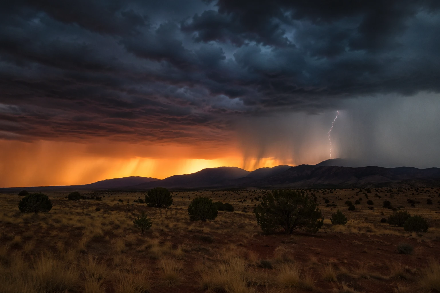
Isolated dry thunderstorms were expected across the greater Four Corners region, the eastern Great Basin and the Wyoming Basin. Thunderstorm forward speeds could reach 30 to 35 mph from southern Nevada into the Four Corners area, a pace fast enough to limit surface rainfall and leave new ignitions little moisture to work with. Gusty outflow winds could have a considerable impact on existing wildfires where fuel dryness was near-record.
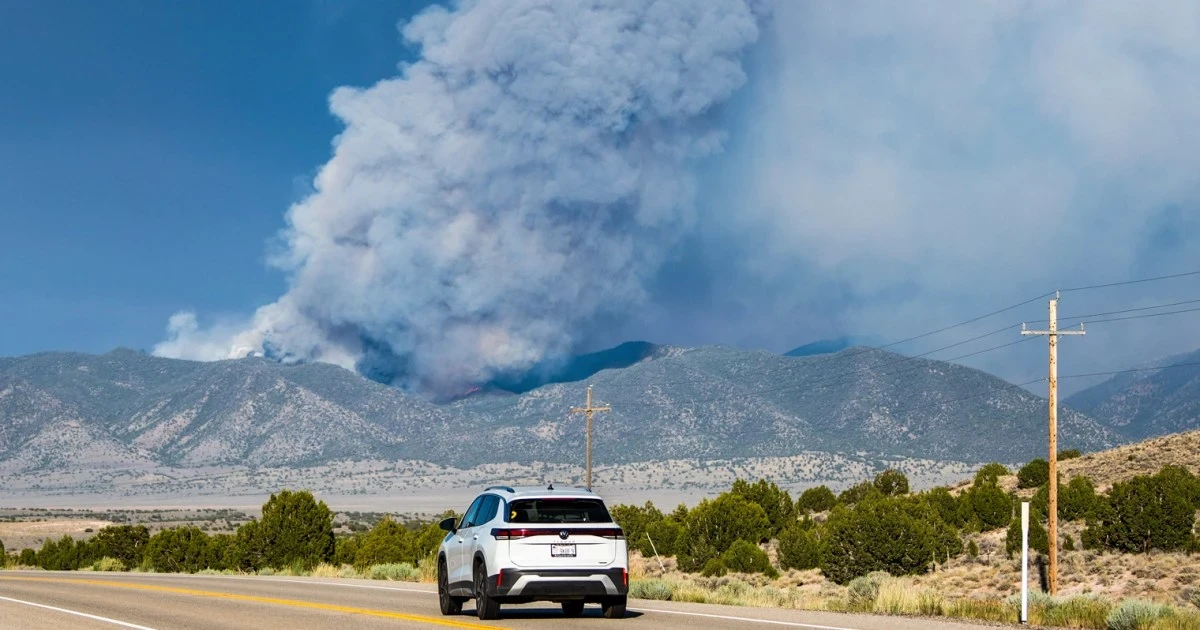
National Fire News put the National Preparedness Level at 3, with 77 new fires reported nationwide the previous day, 31 large fires still uncontained and nearly 5,900 personnel assigned across the country. So far in 2026, 34,262 fires had burned more than 2.7 million acres, both above the 10-year average for this point in the year. In the Great Basin, crews were responding to major fires in Utah and Nevada, including the Cottonwood Fire near Beaver, Utah, where extreme fire behavior, threatened structures, evacuations and road closures were already in play. The Iron, Hastings, Grapevine and Kane Springs fires were also active, with wind-driven runs, spotting and torching helping push growth.
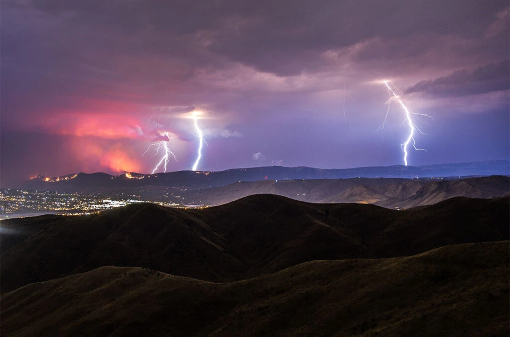
Basil Newmerzhycky, a forecaster for the Great Basin Coordination Center, said fire danger would be very high to extreme from Friday into the weekend as lightning moved through southern and eastern areas and strong winds followed for several days. Daniel Swain, a climate scientist at UCLA and the National Center for Atmospheric Research, said much of the West was primed by very low vegetation moisture, very dry fuel and a lot of wind, in the middle of summer fire season during a significant drought. Glen Merrill, a National Weather Service meteorologist and hydrologist in Salt Lake City, said Utah could see widespread 40- to 50-mph gusts, strong enough to make any new fire grow quickly.
The National Weather Service office in Phoenix placed parts of southwest and south-central Arizona and southeast California under a Fire Weather Watch from Friday morning through Saturday evening, then extended another watch through Sunday evening in some areas. Minimum relative humidity was forecast to fall to 5% to 15% Friday, with winds increasing into the 20- to 35-mph range and a risk of extreme fire behavior. A Forest Service research summary published this spring found the West had gone through a widespread snow drought, leaving mountains remarkably bare and adding to the region’s vulnerability as the cold front moves through.
Sources
- [1]nbcnews.com
- [2]forecast.weather.gov
- [3]nifc.gov
- [4]research.fs.usda.gov