Science
Deep-sea tools reveal Earth’s last unmapped frontier
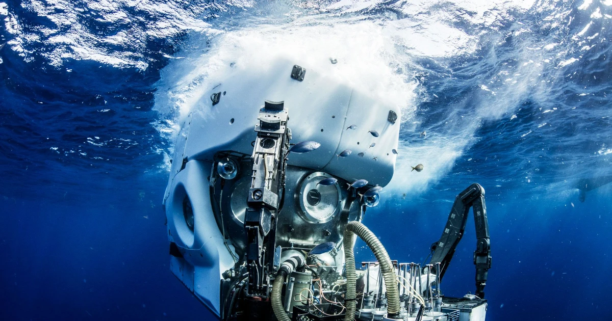
The deep ocean is no longer just the planet’s least visible place. A new toolkit is making it measurable, with drillships that recover buried rock, sensors that listen on the seafloor, fiber-optic cables that can double as observatories, and Alvin, the crewed submersible that still carries scientists where machines and satellites cannot.
That shift matters because the deep sea is where plate motion, earthquakes, carbon storage, marine ecosystems and heat exchange leave their most important traces. It is also where governments and researchers are now confronting a simple fact: the ocean floor is not an empty expanse, but infrastructure, hazard zone and archive at once.
Drillships that recover the buried record
Scientific ocean drilling remains the clearest way to read what lies beneath the seafloor. By bringing up core samples, drillships let researchers see layers of sediment and rock that record past tectonic movement, long-term climate shifts and the chemistry of ancient oceans. The Integrated Ocean Drilling Program concluded in 2024 after eleven successful years of enabling that work, marking the end of an era in subseafloor science.
The institutional picture has changed as much as the technical one. The National Science Foundation chose not to renew its cooperative agreement with Texas A&M University for operations and maintenance of JOIDES Resolution, and said the vessel’s final year of full NSF-provided operations was fiscal year 2024. NSF describes JOIDES Resolution as a light drillship, while Japan’s Chikyu serves as the heavy drillship used for deep drilling projects in the broader program, which shows how much the field now depends on international platforms rather than one flagship vessel.
That shift is more than administrative. It shapes what can be sampled, how often expeditions can sail, and how quickly scientists can answer questions about the Puerto Rico Trench, the Mid-Cayman Rise and other faulted corridors where deep rocks and deep water meet. The tool is still essential, but access to it is now a matter of coordination, funding and shared capability.
Sensors that stay in the dark
If drillships recover the past, long-duration sensors capture the present. Devices placed on or near the ocean bottom can record signals that would otherwise vanish before ship-based teams can observe them, including seismic motion, fluid flow and the subtle deformation of the seafloor. That is especially important in places where hazardous processes unfold faster than traditional fieldwork can follow.
The value of those sensors is in persistence. Deep-ocean instruments can sit in pressure and cold for long periods, waiting for the rare event that reveals how faults move, how underwater landslides begin or how volcanic systems change beneath the crust. For hazards science, that means a better chance of understanding the mechanics behind earthquakes and tsunamis before they become coastal disasters.
The same approach also has climate and ecological consequences. Seafloor sensors can help researchers connect geological activity to carbon burial, methane release and habitat changes, which makes them central to questions that sit between Earth science and environmental policy. In a place as difficult to reach as the deep sea, the ability to keep recording is often the difference between a guess and a measurement.
Fiber-optic cables turned into observatories
The biggest leap may come from infrastructure that already spans the ocean floor. More than 1.48 million kilometres of underwater fibre-optic cables carry almost all global internet and telephone traffic, and researchers are now exploring whether that network can also serve as a planetary sensing grid. The scale is extraordinary: a communications system built for data transfer could become a distributed instrument for monitoring Earth itself.
The FOCUS project says this approach could create a seismological monitoring network of unprecedented scale. Its materials also note that laser reflectometry can detect strains smaller than 1 mm over distances of 10 to 200 km, which is the kind of precision that could reveal how the seafloor flexes before, during and after tectonic events. European research summaries say the same strategy could improve tsunami and earthquake warnings while helping scientists monitor climate change and tectonic activity.
That has direct institutional implications. Undersea cables are already strategic assets, which means any effort to use them as sensors sits at the intersection of science, telecom policy and national security. The opportunity is clear: a wider, cheaper, more continuous view of ocean processes. The unanswered question is governance, including who controls access, how data are shared and how to balance environmental monitoring with the security of critical communications lines.
Alvin and the human eye in a sensor age
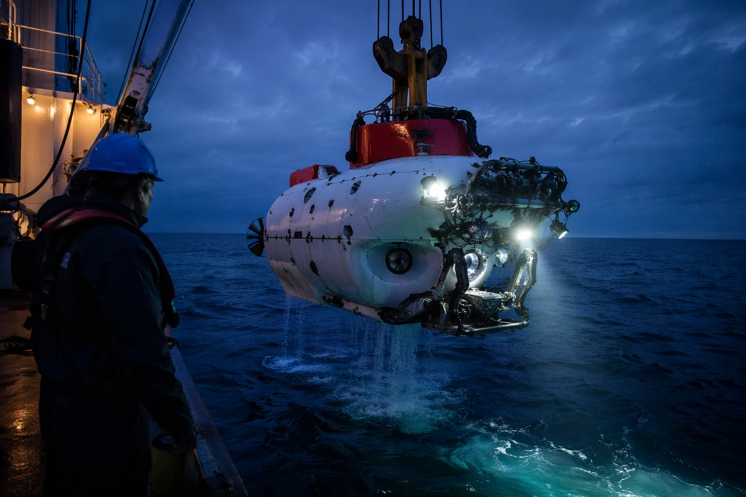
Even as remote systems expand, Alvin remains a decisive part of the deep-ocean toolkit. The submersible was commissioned in June 1964 and can carry two scientists and a pilot to 6,500 meters for up to twelve hours, according to Woods Hole Oceanographic Institution and NSF. That combination of depth, endurance and human presence gives researchers something sensors cannot: direct observation, visual judgment and the ability to react in real time.
Alvin’s role is especially clear in places where the seafloor is visually complex or geologically active. A pilot can steer toward a fracture, outcrop or vent field, and the scientists onboard can choose samples or camera angles on the spot. In an era increasingly defined by automation, Alvin keeps the field connected to the actual terrain beneath the water.
The submersible also shows how long this line of exploration has been running. More than six decades after commissioning, it still bridges the gap between new electronic sensing systems and the oldest method in geology, looking closely at the rock itself. That continuity matters because the deep ocean is not solved by one instrument, but by tools that can confirm, compare and correct one another.
What these tools may finally answer
Taken together, the four tools change the deep sea from a blank space into a layered system. Drillships read buried history, seafloor sensors track live motion, fibre-optic cables expand coverage across vast distances and Alvin lets scientists inspect the terrain directly. The combined effect is a far better chance of seeing how faults rupture, how carbon is stored, how biodiversity is distributed and how underwater landslides or quakes may develop.
The biggest unanswered questions are still the ones with the widest consequences. How much carbon and heat does the deep ocean hold? Where do hazards originate, and how much warning can be pulled from subtle shifts in pressure, strain or temperature? Which parts of the seabed are biologically rich, geologically unstable or strategically sensitive?
Those are not abstract research problems. They are questions about climate forecasts, disaster readiness and the governance of a frontier that remains largely unmapped. The deep ocean is becoming observable, and that changes what can be known, what can be protected and what can no longer stay hidden.