Science
Inside the Contours of the James Bay Lowlands
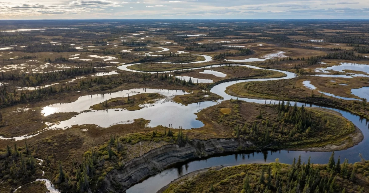
The James Bay Lowlands, stretching across northern Ontario and extending into parts of Quebec and Manitoba, represent one of the largest and most ecologically significant wetland regions in North America. Recent research and satellite imagery from NASA, alongside ongoing geoscientific studies, continue to shed light on the complex contours and environmental importance of this vast landscape.
The Geography and Formation of the Lowlands
The James Bay Lowlands cover an estimated 103,600 square kilometers, bordered by the Canadian Shield to the south and James Bay to the north. The region is defined by its flatness, extensive peatlands, and thousands of interconnected lakes and rivers. According to Natural Resources Canada, the underlying bedrock is primarily Paleozoic limestone and dolomite, overlaid by thick layers of glacial deposits and peat, resulting from millennia of post-glacial processes.
- The Lowlands formed as glaciers retreated about 7,000 years ago, leaving behind a landscape dominated by muskeg, wetlands, and permafrost.
- Elevation rarely exceeds 100 meters above sea level, contributing to widespread surface water accumulation and complex drainage patterns.
Hydrology and Environmental Importance
The James Bay Lowlands are critical for North America’s water resources. The peatlands act as natural water filters and major carbon sinks. According to a 2020 study in the Journal of Geophysical Research: Biogeosciences, the region’s peatlands store more than 35 gigatonnes of carbon, making them essential to global climate regulation. The area’s hydrology is characterized by slow-moving rivers and seasonal flooding, which sustain unique habitats for migratory birds and wildlife.
- Extensive monitoring using satellite data has improved the understanding of seasonal water dynamics and permafrost changes.
- The USGS Wetland Inventory details the diversity of wetland types, including bogs, fens, and marshes, supporting rare plant and animal communities.
Geological and Ecological Research
NASA’s ongoing work in the region, highlighted in "Contours of the James Bay Lowlands," is complemented by field campaigns and geoscientific expeditions. The PANGAEA database catalogs sediment cores and geochemical analyses, providing insights into the area’s climate history. The Centre d’études nordiques (CEN) is also conducting long-term studies on permafrost dynamics, hydrology, and ecological change.
- Recent findings indicate that permafrost thaw and changing hydrological regimes are altering peatland stability and greenhouse gas fluxes.
- Understanding the region’s contours is vital for predicting responses to climate change and for Indigenous communities whose livelihoods depend on the land and water.
Looking Ahead: Climate and Conservation
As the climate warms, the James Bay Lowlands face new challenges, including increased permafrost thaw, altered water cycles, and potential industrial development. Scientists and policymakers are leveraging remote sensing and field data to inform conservation strategies and sustainable resource management. The region’s future depends on a nuanced understanding of its contours—from bedrock to peat surface—and ongoing collaboration between Indigenous knowledge holders, researchers, and government agencies.
The story of the James Bay Lowlands is one of geological legacy, ecological richness, and profound environmental significance. As science continues to map its contours, the region remains a key focus for understanding and mitigating the impacts of global change.