US News
Iowa county records 94 mph wind gust as severe storms spread
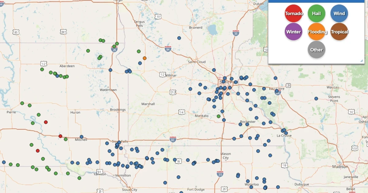
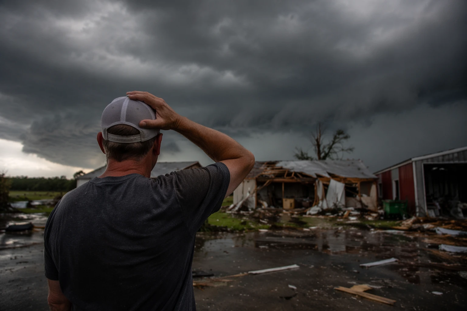
Marshall County, Iowa, recorded a 94 mph wind gust before sunrise as severe storms tore through the state and more rounds threatened later in the day. The highest tornado threat was centered farther east over Illinois and Indiana, but Iowa had already been hit by damaging winds strong enough to signal a hazardous day ahead.
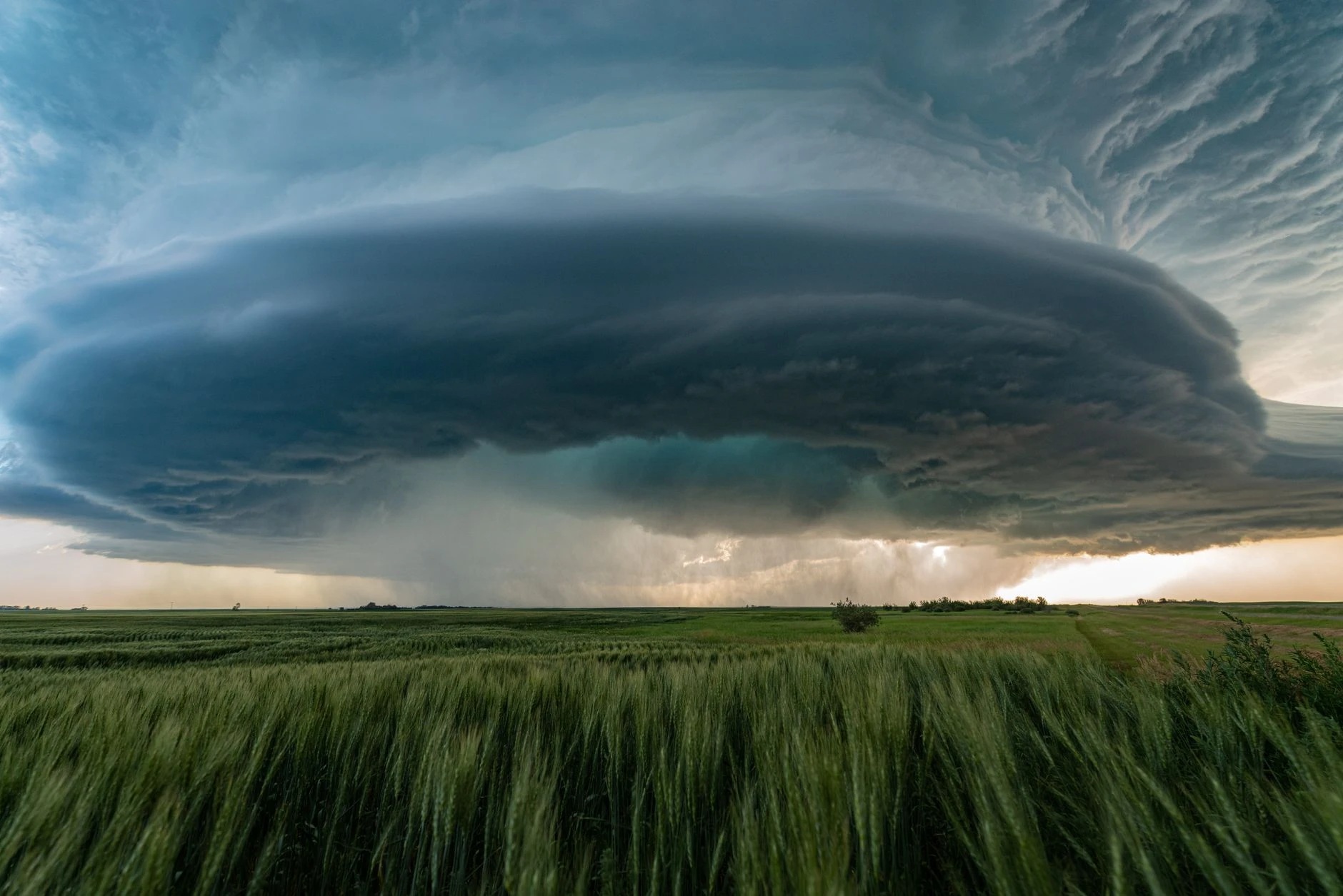
National Weather Service forecasters said measured wind gusts above 80 mph had already occurred before dawn, underscoring how quickly the storm complex intensified. In its Wednesday outlook, the Storm Prediction Center said the outbreak could bring several intense tornadoes, damaging gusts over 75 mph and wind-driven large hail, with the fast-moving system already shifting southeast from Iowa into Illinois.
In Des Moines, weather forecasters said severe storms were moving across Iowa in the coming hours, with large hail and damaging winds as the primary threats. The office warned that additional severe storms were expected beginning around midday in southeast Iowa, where tornadoes could not be ruled out. Its forecast discussion said storm winds over 45 mph would be common Wednesday, with severe winds above 58 mph possible and downbursts capable of producing gusts of 70 mph or more.
The timing added to the risk. Forecasters said storms were likely along the I-35 corridor by about 6 a.m., bringing the first round of damaging weather during the morning commute and leaving little time for complacency. The National Weather Service weather story for Iowa said officials were monitoring two rounds of severe storms Wednesday, one in the morning and another possible redevelopment later in the day, with locally heavy rain also in the mix.

The setup stretched across the broader Midwest, where the Storm Prediction Center placed the peak severe threat over Illinois and Indiana while Iowa dealt with the early edge of the outbreak. With one storm complex already producing destructive winds and another round possible later, the day carried the hallmarks of a compounding severe-weather event: early damage, renewed instability and the chance for tornadoes, hail and more damaging wind as the system continued southeast.
Sources
- [1]nytimes.com
- [2]forecast.weather.gov
- [3]weather.gov