World
Living in the shadow of Wales' M4 motorway

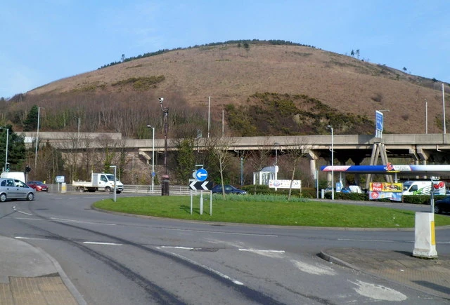
Under the M4’s 45ft-high pillars in Port Talbot, the motorway is not an abstract route on a map. It is the overhead presence that shapes how a street sounds, how hot it feels in summer, where children play and how a home sits in the townscape. Wales’ first motorway opened in 1966, but its deepest impact in Port Talbot is still felt in the ordinary routines of people living beneath it.
A road planned long before the concrete arrived
The M4 was first studied as a major access road to south Wales in 1920, then advanced through county council proposals in the late 1930s before a design was completed in 1949. That long planning arc matters because it shows the motorway was never just a post-war engineering job. It was a political decision that took decades to crystallise, and the eventual route fixed a choice about who would gain speed and who would absorb the damage.
When the road opened in South Wales in 1966, it was hailed as a major engineering achievement and as Wales’ first motorway. But the build required the demolition of large swaths of Port Talbot and displaced hundreds of people from homes and businesses. Groes, south of Port Talbot, was later demolished in 1976 to make way for Junction 39, extending the reach of the same infrastructure into another community.
A documentary photography project on Port Talbot, Bypassed, captures that legacy as more than a line of traffic. It frames the motorway as a force that altered the town’s physical and psychological landscape, leaving a route that still defines the way parts of Port Talbot look, sound and feel.

Life beneath the pillars
For some residents, the space under the motorway has become part of daily life rather than a symbol of loss. One account of families living beneath the concrete structure in Port Talbot describes the area as not pretty, but notes that the children love it. The same coverage says the elevated road can even act like shelter in hot weather because it throws shade over the homes below.
That shade is a practical benefit, but it sits beside a less comfortable reality: the motorway never fully disappears. Noise from a major road is constant enough to become a backdrop to conversation, sleep and play, even when people adapt to it. The motorway’s physical form, 45ft-high pillars lifting traffic above the homes, creates a distinctive kind of housing that offers open space below the roadway while also reminding residents that they live beneath a transport system built for movement, not for domestic comfort.
This is where the infrastructure story becomes an inequality story. The same road that improved regional mobility also imposed a lasting local burden on the streets directly underneath it. Households in Port Talbot inherited the shadow, the vibration, the visual bulk and the social stigma of living under a motorway, while the wider region benefited from faster travel and better access.

Why the M4 is still central to south Wales
The M4 is not a small-town byway. BBC coverage has described it as both south Wales’ economic lifeblood and its commuting Achilles heel, a phrase that captures the contradiction at the heart of the road. It serves the 2.2 million people who live in south Wales, and for many of them it remains the main spine for work, trade and travel.
The scale of that dependence is easy to see in traffic counts. A BBC report on a stretch near Bristol said about 4,000 vehicles use that section of the motorway every hour during peak weekend times. Even that single figure suggests why the route is so politically sensitive: when the road slows or closes, the effect is felt far beyond one town or one junction.
The motorway’s length also matters. At about 78 miles, or 125km, in the Welsh context, it is not just a road through a landscape but a corridor that binds together cities, suburbs and industrial towns. Newport, Port Talbot and the broader south Wales coast are all tied into its logic, which is why debates about the M4 are never only about transport engineering. They are also about commuting patterns, access to jobs, the distribution of noise and the value placed on the communities that sit closest to the tarmac.
The long cost of a short route
The M4 shows how major transport projects can produce winners and losers over generations. It delivered a strategic link for south Wales, but its route through Port Talbot required homes and businesses to be cleared, then extended that disruption with later work such as Junction 39 at Groes. The result is a corridor where mobility and harm coexist, and where the burden of national connectivity is still carried most visibly by the people who live closest to the road.
That is why the motorway remains such a useful lens on public policy. A road can be celebrated as a technical success and still leave behind a fractured urban fabric, altered land use and daily conditions that shape sleep, heat exposure and the feel of a neighbourhood. In Port Talbot, the M4 is both infrastructure and inheritance, and the cost of that inheritance is written into the streets beneath it.