World
NASA radar campaign over Panama and Peru tracks floods and forest health
Cloud cover that often hides tropical landscapes from ordinary satellites is now the target. NASA’s radar flights over Panama and Peru are collecting measurements that can improve flood forecasting, water planning and forest monitoring in places where heavy clouds and dense vegetation make disaster risk harder to see.
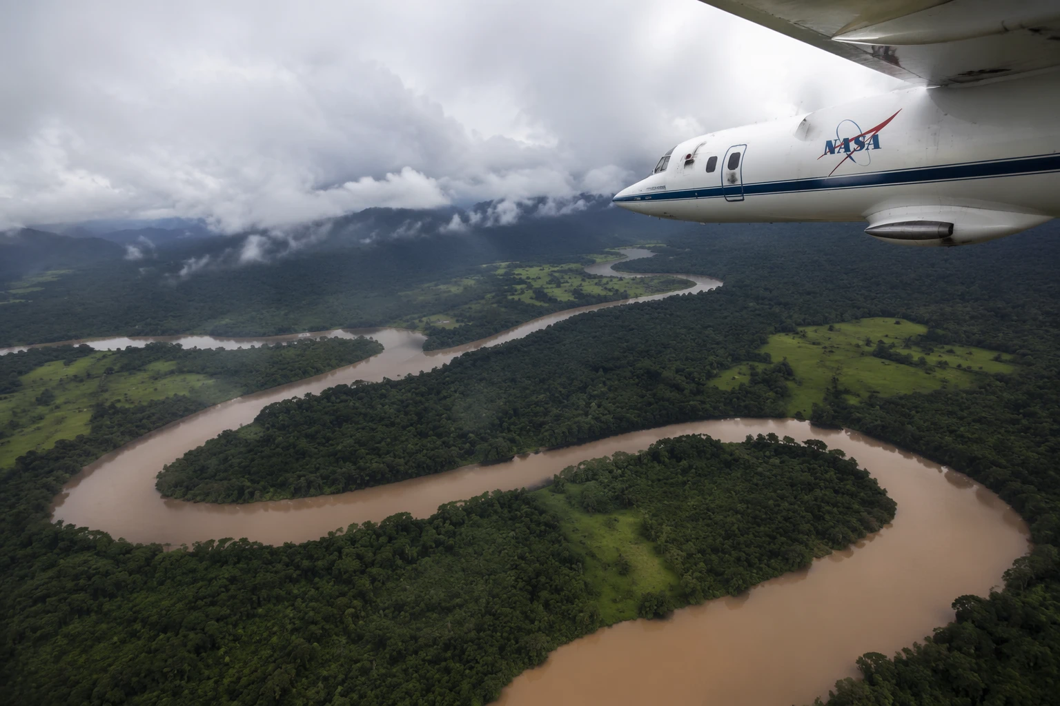
The TropiSAR 2026 campaign ran from May 1 through May 31 and concluded on June 4 after 17 flights totaling 75 hours. NASA used a C-20A aircraft from the NASA Armstrong Flight Research Center in Edwards, California, carrying UAVSAR, the airborne radar system developed at NASA Jet Propulsion Laboratory, to scan landscapes where water moves quickly across forests, wetlands and mountain slopes.
In Peru, the campaign was designed to do two jobs at once: help communities and scientists understand flood extent and glacier movement, while also validating NISAR, the Earth-observing satellite that launched on July 30, 2025, from India’s Satish Dhawan Space Centre. NASA said the airborne radar data were collected at the same times and locations as NISAR observations to help calibrate the satellite’s L-band radar, a test that matters for tracking changes in land, ice, water and vegetation.
The validation work focused on Pacaya-Samiria National Reserve, one of the world’s largest protected flooded forests, and Huascarán National Park, home to the largest concentration of tropical glaciers. NASA also extended the project to the Los Amigos Reserve to map forest biomass and improve estimates of carbon storage and ecosystem health. Those measurements matter far beyond the Andes and the Amazon: floods, land-cover change and water dynamics in these regions affect millions of people and can ripple through food systems, migration pressures and the climate models used in the United States.

Peruvian officials said the campaign built on coordination that began in August 2024 with Sernanp and CONIDA and intensified during 2025. The planned sites include Pacaya Samiria, Los Amigos, Tambopata, El Sira, Machupicchu and Huascarán, a spread that reflects both the scientific range and the practical stakes of monitoring some of the country’s most vulnerable terrain.
The same radar approach is also being used in Panama. The U.S. Embassy in Panama said NASA’s C-20A and scientists were in the country from May 3 through May 9, 2026, for AVUELO, a separate campaign with the Smithsonian Tropical Research Institute. STRI said the 2026 work combines airborne synthetic aperture radar with field measurements of vegetation water content and forest structure to improve calibration of spaceborne vegetation data, while UAVSAR’s cloud-penetrating view can capture everything from forest canopies to mangroves. STRI’s earlier 2025 AVUELO campaign collected more than 900 samples from over 400 plant species in central Panama, linking airborne pixels to the living systems on the ground.

Taken together, the Panama and Peru flights show NASA using Earth observation not as a distant science exercise but as infrastructure for resilience. The same data that help validate a satellite mission can also sharpen flood alerts, guide water planning and strengthen the ability of vulnerable communities to prepare before the next storm or melt pulse arrives.
Sources
- [1]nasa.gov
- [2]science.nasa.gov
- [3]uavsar.jpl.nasa.gov
- [4]pa.usembassy.gov
- [5]striresearch.si.edu
- [6]gob.pe
- [7]stri.si.edu