Science
NASA satellite reveals giant Pacific tsunami behaved more complexly than expected
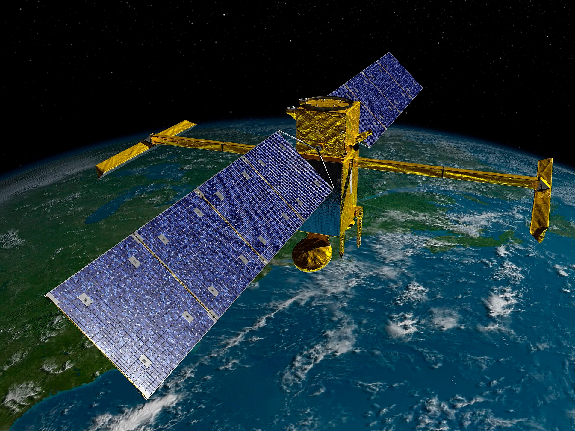
NASA’s Surface Water and Ocean Topography mission captured the July 29, 2025, Kamchatka tsunami in a way ocean scientists had never seen before, and the result was not a clean single wave but a far messier Pacific-wide pattern. The satellite view showed the tsunami spreading, scattering and interacting across the ocean in ways older models had not anticipated, turning a distant earthquake into a new test of how warning systems read the sea.
The quake behind the wave was magnitude 8.8 and ranks as the sixth-largest earthquake recorded anywhere in the world since 1900. That scale made it an unusually powerful case study for tsunami science, especially because it came from a subduction-zone rupture, the kind of offshore faulting that can generate the most dangerous waves. The new research combined SWOT observations with readings from DART deep-ocean buoys, giving scientists a more complete picture of how the wave field traveled and how the source rupture may have unfolded.
Angel Ruiz-Angulo of the University of Iceland, the study’s lead author, said the new data were like a “new pair of glasses,” because they let researchers see the ocean-wide structure of the wave field rather than just a few isolated measurements. That matters because tsunami warning centers have long relied on sparse observations and narrow satellite tracks to infer what is happening over thousands of kilometers of open water. SWOT changed that geometry.
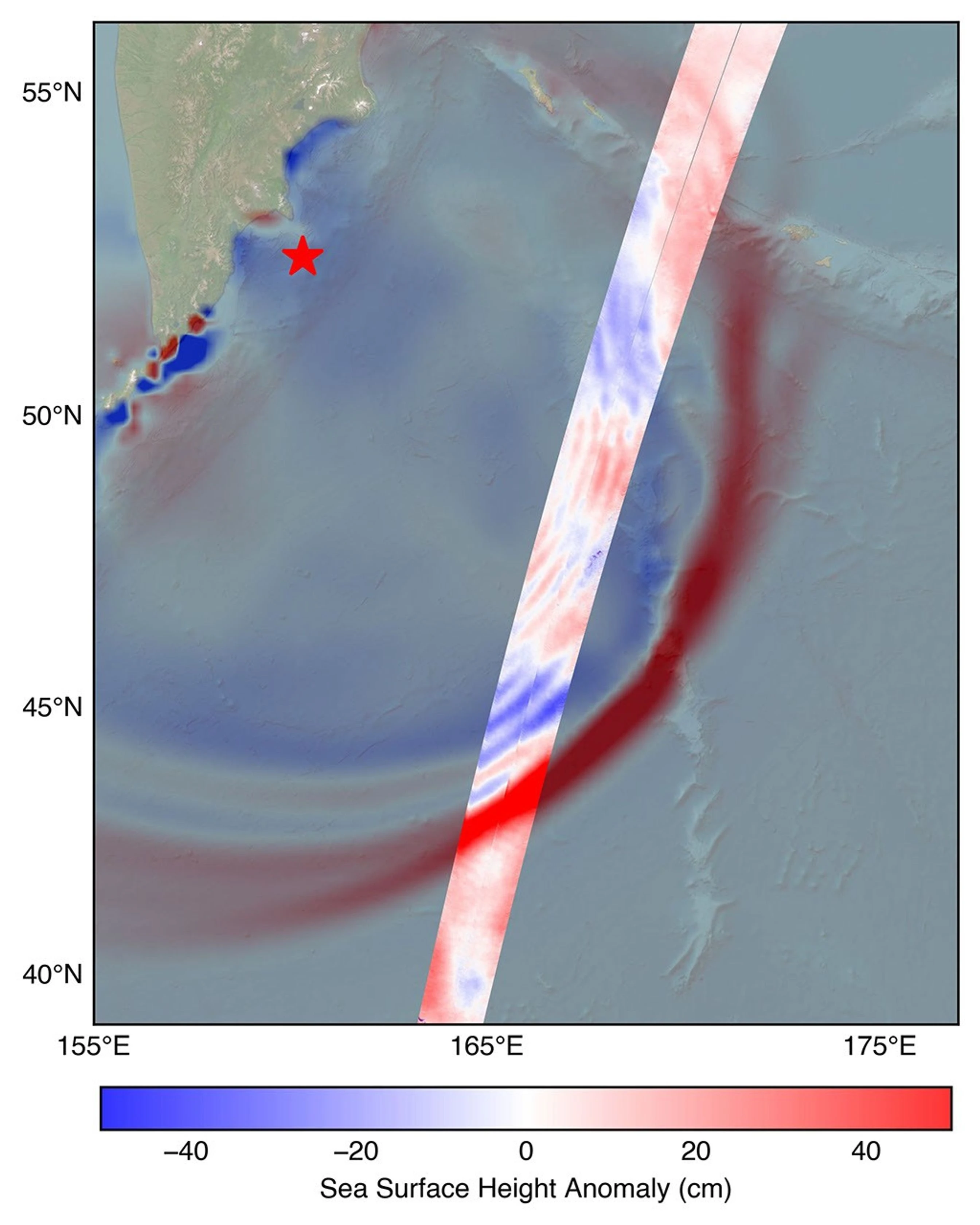
The mission can capture a swath up to about 120 kilometers wide, far broader than earlier satellites that only produced thin tracks. Launched in December 2022, the satellite is still early in its life, but the Kamchatka event showed how quickly it can alter disaster science. The observation was the first high-resolution, wide-area satellite view of a major tsunami generated by a subduction-zone earthquake, and that reach allowed researchers to watch the wave energy disperse across the Pacific instead of assuming it traveled as a relatively simple front.
That difference has direct consequences for warning systems and coastal planning. If tsunamis can carry more dispersive energy and interact more intricately than many earlier assumptions allowed, models will need to reflect that behavior to improve forecasts and shorten response times. For Pacific coastal communities and other tsunami-prone regions, the lesson is not abstract: better structure in the data can mean more precise risk maps, faster alerts and fewer surprises when the ocean starts moving.