US News
NOAA’s Hurricane Hunter planes fly into storms to improve forecasts
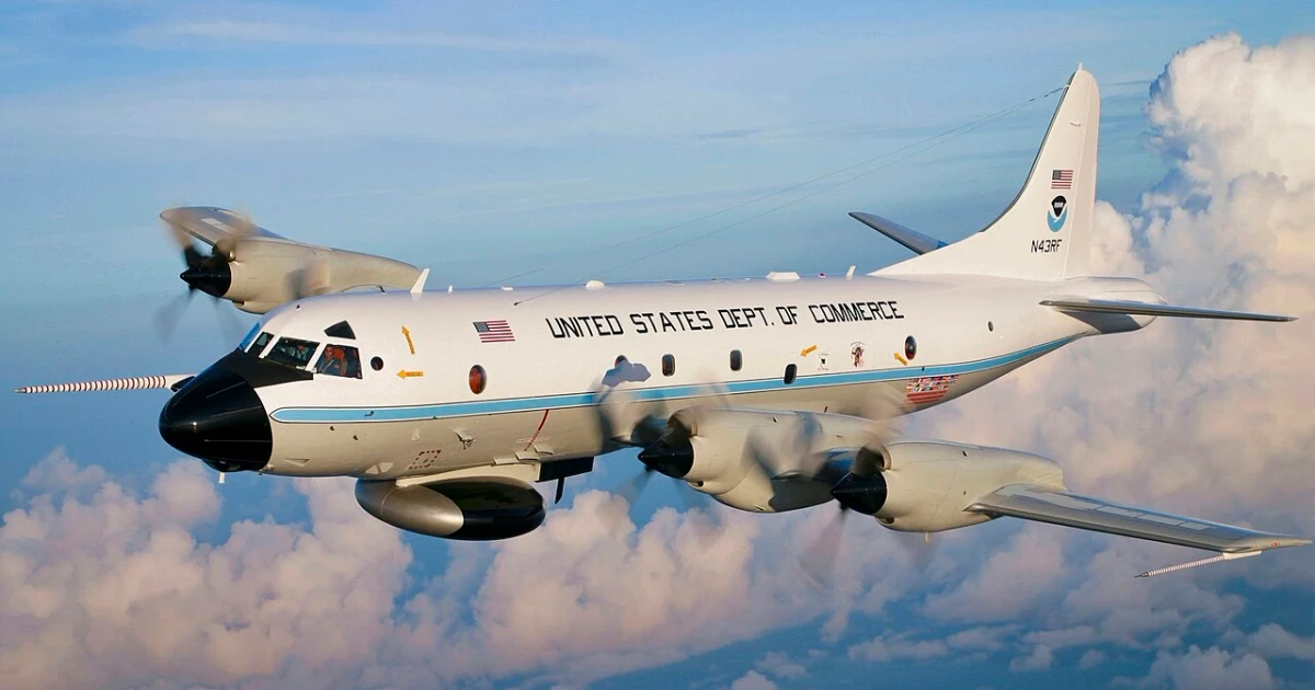
Kermit, Miss Piggy and Gonzo sound playful until they bank into a hurricane. NOAA’s aircraft fly through the worst weather on purpose, collecting pressure, wind and temperature data that forecasters use to tighten track and intensity predictions before a storm closes in on millions of people deciding whether to evacuate, board up or stay put.
How the storm flights sharpen forecasts
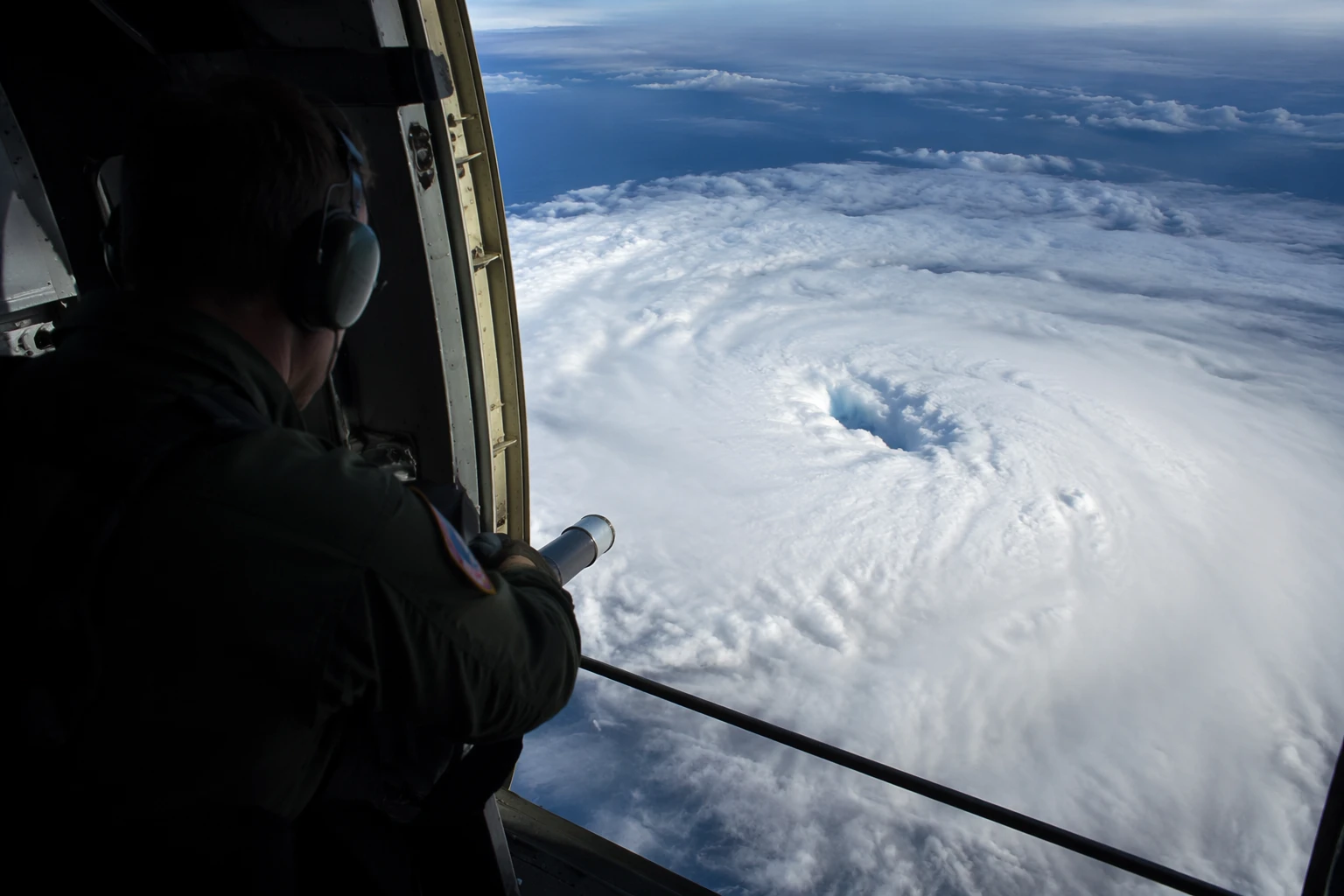
NOAA’s two Lockheed WP-3D Orion turboprops, Kermit and Miss Piggy, are the backbone of the Hurricane Hunter mission. Their typical sorties last 8 to 10 hours and take them repeatedly through the eyewall, where the storm is most violent and the structure is changing fastest. Scientists aboard release GPS dropwindsondes that transmit pressure, humidity, temperature, wind speed and wind direction as they fall through the storm.
The aircraft also carry tail Doppler radar and lower-fuselage radar, which together give a three-dimensional picture of the hurricane’s core. That stream of information feeds directly into the National Hurricane Center and into global hurricane models, the systems that turn raw observations into the forecast cones and intensity guidance emergency managers rely on.
Why the fleet includes a jet above the storm
Gonzo, NOAA’s Gulfstream IV-SP jet, works the storm from a very different altitude. The aircraft flies at about 45,000 feet and has a range of 4,000 nautical miles, high enough to map the steering currents that push a hurricane toward one coast or another. Those upper-level winds often determine whether a storm curves harmlessly out to sea or comes ashore in a densely populated corridor.
The P-3s can also deploy airborne expendable bathythermographs, instruments that measure ocean temperature by depth. Warm water fuels hurricanes, and a storm passing over a deep warm layer can intensify more quickly than one crossing cooler water. Together, the P-3s and the G-IV give forecasters both the storm’s internal structure and the larger atmosphere around it, which is why the mission uses several aircraft instead of one.
A flying lab used far beyond hurricanes
The WP-3Ds have worked the Atlantic, the Caribbean, the Gulf of Mexico / Gulf of America and the Eastern Pacific, where they have supported both hurricane and tropical-storm research. NOAA also uses them for atmospheric and oceanographic work well beyond tropical cyclones, including studies of winter storms, atmospheric gases, aerosols and severe convection.
NOAA’s fleet includes 12 scientific research, reconnaissance and surveillance aircraft overall. That larger fleet gives the agency flexibility to move between missions, but the P-3s remain the most recognizable face of the Hurricane Hunter program because they can fly into conditions that would end a normal research sortie. As one pilot of the meteorological research planes put it, “For the most part, the aircraft have their own souls.”
The crews behind the missions
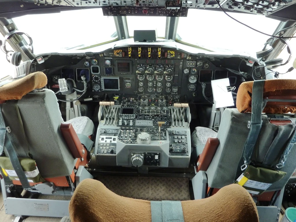
The flying is only part of the operation. NOAA flight engineer Dan Tyson, who brought 11 years of Navy experience to the job, said flight engineers handle both routine and emergency procedures and can end a mission if conditions become too extreme.
The planes leave from NOAA’s aviation operation with a specific objective: collect enough observations to reduce uncertainty in the forecast. Every dropwindsonde, radar sweep and ocean probe is part of a chain that begins in the storm and ends with a forecast discussion, a model run and a decision by a local official or household.
A program with roots in 1956
NOAA traces airborne hurricane research back to the U.S. Weather Bureau’s National Hurricane Research Project, which began in 1956. That work later evolved into the Research Flight Facility in 1961, laying the groundwork for the modern Hurricane Hunters. The current WP-3Ds were obtained new from the Lockheed production line in the mid-1970s, after the Department of Commerce bought them in 1975 to replace aging DC-6 research planes.
N42RF, Kermit, made its first tropical-cyclone flight on June 27, 1976, when it departed Acapulco to intercept Hurricane Bonny in the eastern Pacific. The plane reached its 50th year of operational service even as sensors, models and computing power evolved.
Why the 2025 season still set records
In 2025, NOAA’s Hurricane Hunter aircraft logged 417 flight hours across 63 total flights into and above six hurricanes, three of them category 5. The fleet also deployed more than 1,300 instruments, including GPS dropsondes and uncrewed systems.
What comes next for the fleet
NOAA has already begun planning to replace the WP-3Ds with modified C-130Js by 2030.
Sources
- [1]nytimes.com
- [2]omao.noaa.gov
- [3]noaa.gov