US News
Potential Tropical Cyclone One could become season’s first storm
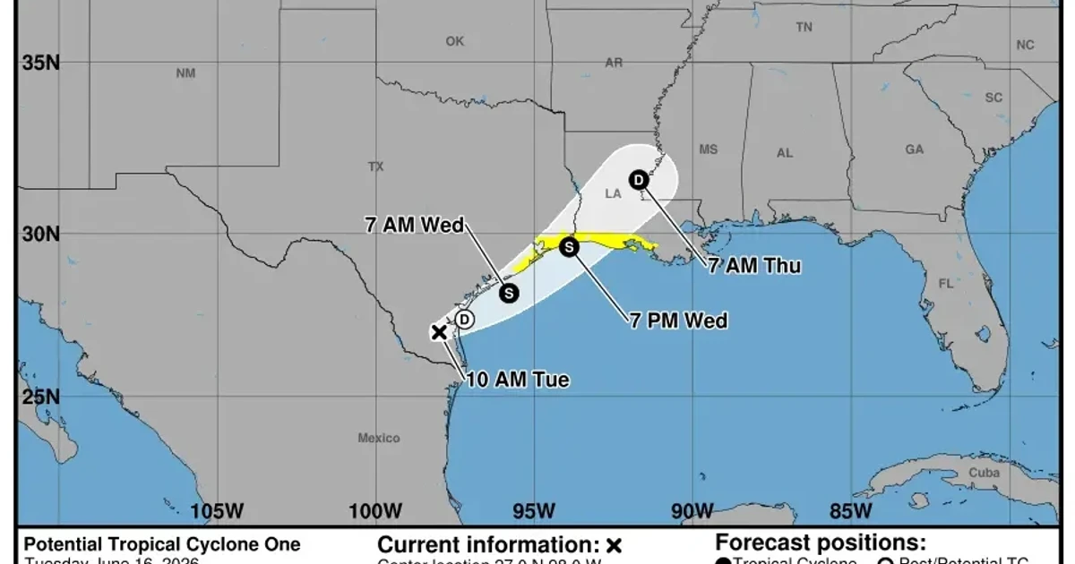
Gulf Coast officials were moving to prepare for heavy rain, flood threats and possible tropical-storm watches as Potential Tropical Cyclone One tracked over south Texas with its next move aimed at the northwestern Gulf of America. The system had not yet become a named storm, but forecasters said it could organize into a short-lived tropical storm late Tuesday or Wednesday.
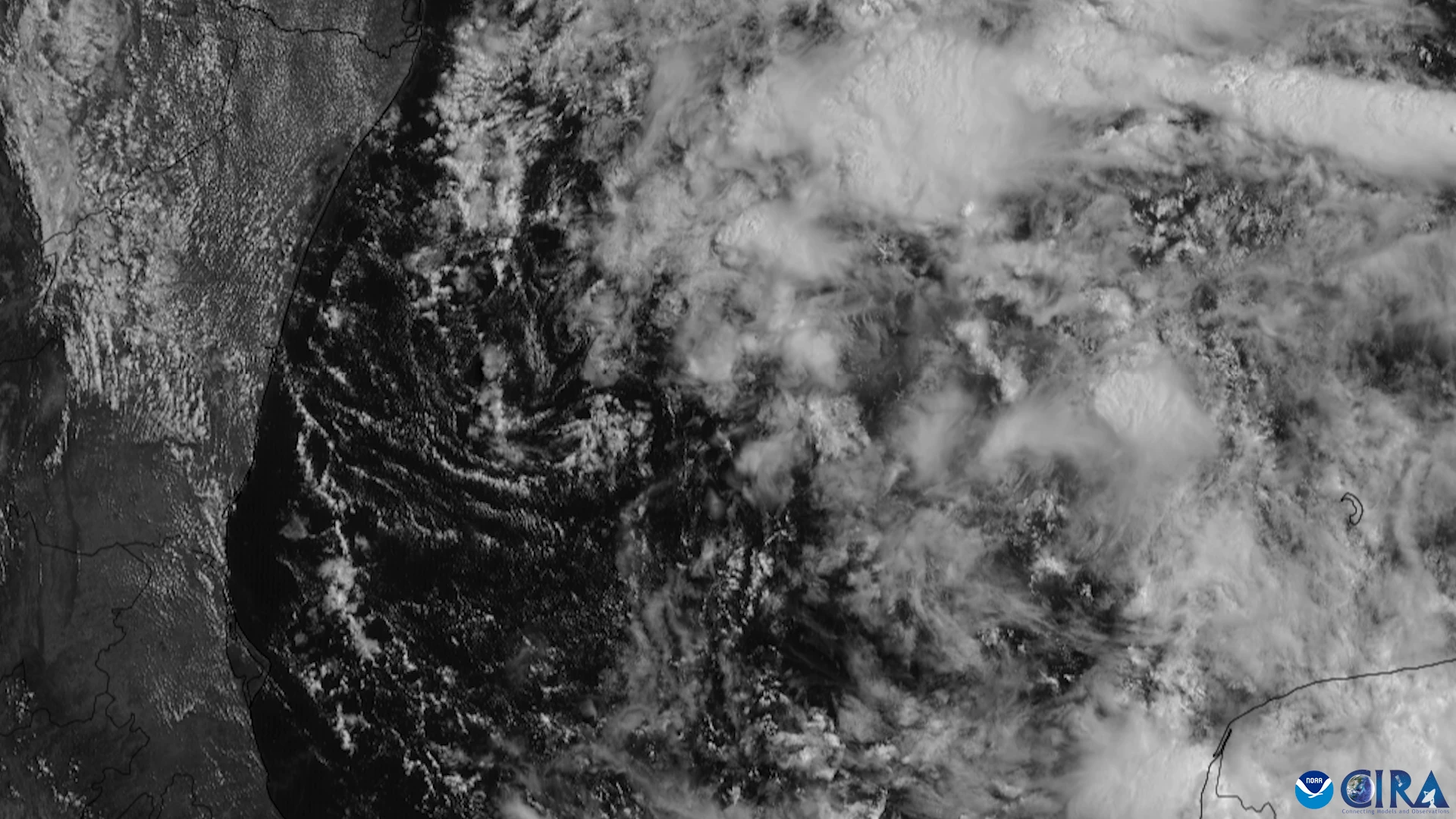
At 1 p.m. CDT Tuesday, the National Hurricane Center placed the disturbance near 27.1 degrees north and 97.8 degrees west, with maximum sustained winds of 30 mph and a minimum pressure of 1006 mb. It was moving northeast at 6 mph after being upgraded from Invest 90L to Potential Tropical Cyclone One, a designation used so watches and warnings can be issued before a cyclone fully forms. Tropical storm watches were already being posted for parts of the northwestern Gulf Coast, including stretches from the Texas coast into southwestern Louisiana.
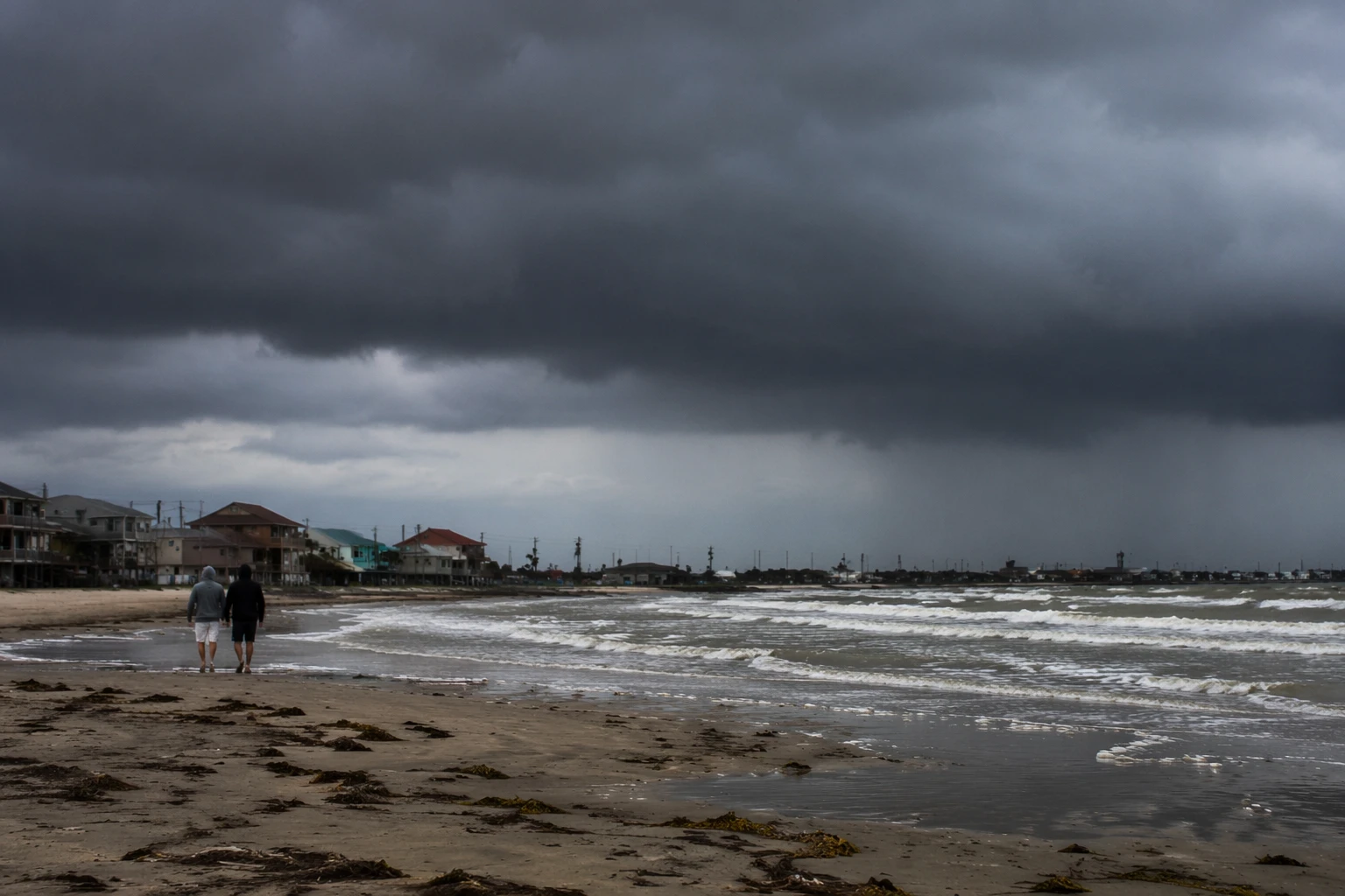
The immediate concern was not wind so much as water. Forecasters warned that southern and eastern Texas, along with parts of Louisiana and Mississippi, could see periods of intense rainfall, dangerous flash flooding, urban flooding and river flooding. One forecast called for 4 to 8 inches of rain through Thursday, with isolated amounts near 12 inches in the hardest-hit areas. Coastal flooding and gusty winds were also possible as the system moved along the Texas coast and potentially emerged over the northwestern Gulf later Tuesday or Tuesday night.
The National Hurricane Center said environmental conditions were only marginally favorable, but enough to support a brief tropical storm late Tuesday or Wednesday. That uncertainty did not reduce the urgency for residents, ports and local governments across the coast, where even a weak tropical system can disrupt road access, drain infrastructure, shipping schedules and emergency response.
The timing also placed the disturbance squarely at the start of hurricane season. The Atlantic season runs from June 1 through November 30, and if the system becomes a named storm it will be called Arthur, the first named storm of 2026. NOAA’s outlook, issued in May, called for a below-normal season overall, with 8 to 14 named storms, 3 to 6 hurricanes and 1 to 3 major hurricanes. Even in a quieter year, forecasters said, one rain-soaked system can still test levees, drainage systems and the communities that live with the fastest-rising water first.
Sources
- [1]cbsnews.com
- [2]nhc.noaa.gov
- [3]noaa.gov
- [4]cpc.ncep.noaa.gov
- [5]gvwire.com
- [6]click2houston.com
- [7]statesman.com