Science
Reuters climate monitor shows world temperatures 2.2 degrees above normal
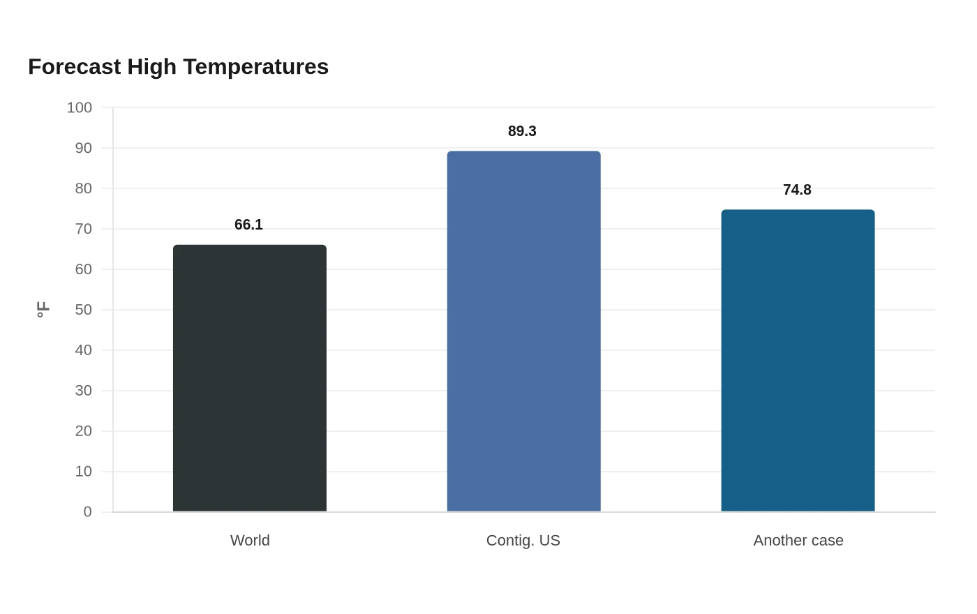
Reuters' Climate Monitor put the worldwide average high forecast at 66.1 degrees Fahrenheit on Aug. 2, 2.2 degrees above the historic average for that date. Built on a 1961-1990 baseline, the graphic turns a single day of heat into a measure of how far daily temperatures are drifting from the long-term norm used by climate scientists.
The tool was created from the question, “Has it always been this hot here this time of year?” Its 30-year reference period means a cold spell in one city does not cancel out a warmer pattern across the broader map.

In the contiguous United States, the average high was forecast at 89.3 degrees Fahrenheit, 3.8 degrees above the normal high for July 29 from 1961-1990. That level of heat can drive up electricity demand as air-conditioning use rises, increase heat stress for outdoor workers, and make already strained power grids more vulnerable during peak load hours.
Elevated temperatures can accelerate evaporation, dry out soils, and place pressure on crops during sensitive growth stages, while longer stretches of warmth can leave grasslands and forests more combustible as wildfire risk rises. In cities, the same heat settles into pavement and buildings, keeping nighttime temperatures high and extending the toll on people who lack adequate cooling.
In another example, the monitor put the average high at 74.8 degrees Fahrenheit, 5.5 degrees above what was typical from 1961-1990.
Climate normals are built on 30-year reference periods, and the next standard normals would shift to 1991-2020, the World Meteorological Organization said in 2021. Reuters' monitor still uses 1961-1990, and the feed is powered by Copernicus Climate Change Service data, with the European Centre for Medium-Range Weather Forecasts implementing the system. Copernicus said Reuters launched the Climate Monitor tool on July 2, 2026.
Sources
- [1]reuters.com
- [2]facebook.com
- [3]climate.copernicus.eu
- [4]wmo.int