US News
Tropical Storm Arthur drenches the South as tornado threat spreads Midwest
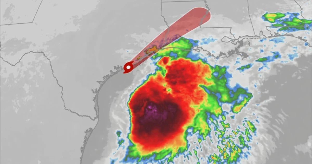
A soaking tropical system in the South and a tornado-laden severe weather outbreak in the Midwest collided into one dangerous national weather picture on June 17, forcing forecasters and emergency managers to track two separate crises at once. Tropical Storm Arthur was drenching Texas, Mississippi and Louisiana, while Illinois, Iowa and Indiana faced a severe thunderstorm outbreak with tornado potential, damaging winds and large hail.
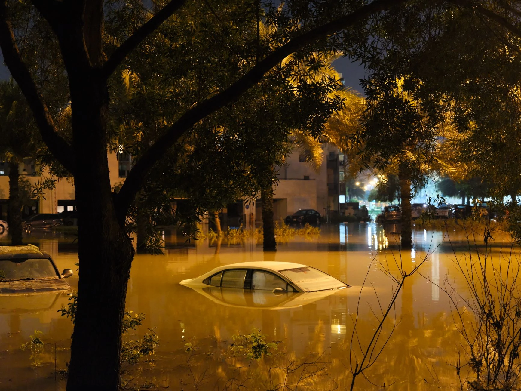
Rob Shackelford said some locations already affected by Arthur had taken on more than six inches of rain, and more heavy rainfall was still possible. The Weather Prediction Center responded by issuing tropical rainfall graphics and excessive rainfall outlooks, a signal that flooding remained a separate hazard even as attention turned to wind and lightning farther north. In the South, the immediate danger was not just the storm itself but the water piling up behind it.
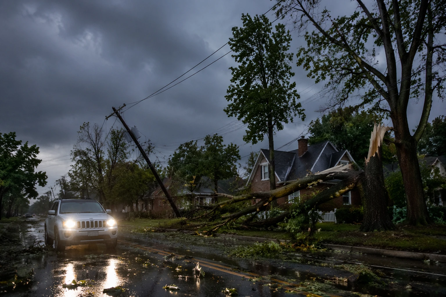
Across the Midwest, the National Weather Service said parts of Illinois faced two rounds of severe thunderstorms and a moderate risk, level 4 of 5, for severe weather. Local warnings cited radar-indicated rotation, quarter-size hail and damaging winds as storms pushed east, with tornado watches remaining in parts of Illinois and Indiana. The Weather Channel said the setup could produce EF2-or-stronger tornadoes across Missouri, Illinois, Indiana and Ohio, with winds as high as 80 mph and hail roughly 2.5 inches in diameter.
The timing made the threat especially difficult. Storms were expected to move into Indianapolis and St. Louis, then stretch overnight from southern Missouri to eastern Ohio, with Cincinnati, Columbus, Pittsburgh and Louisville all in the path of the system by early morning. The forecast raised the concern that storms would stay organized later into the night than usual, giving residents less time to react and emergency crews less margin to stage resources.
The unfolding outbreak also came with fresh scars from the week before. NWS Chicago said the June 11 outbreak had already produced at least 20 tornadoes in its area of responsibility, including 2 EF-2 and 2 EF-3 tornadoes in the local area. NWS event summaries for northern Illinois also identified June 10 as a derecho with widespread wind damage. On June 17, National Weather Service teams were being sent to survey damage near Harpers Ferry, Iowa, after a confirmed large and dangerous tornado warning, and more survey crews were expected in northern Illinois after multiple observed tornadoes. Together, the two-pronged event showed how quickly one season can swing from flooding rain to violent wind, with disruption extending far beyond the storm zones themselves.
Sources
- [1]weather.com
- [2]forecast.weather.gov
- [3]weather.gov
- [4]wpc.ncep.noaa.gov