US News
Winter Storm Maps Reveal Regions Bracing for Heaviest Snowfall as States Mobilize Emergency Response
As a powerful winter storm system moves across the United States, updated forecast maps are providing critical guidance on where snow and hazardous conditions will hit hardest, prompting emergency responses in 18 states. The widespread weather event is expected to impact millions, with authorities urging residents to prepare for potentially severe disruptions.
New Forecast Maps Pinpoint High-Impact Areas
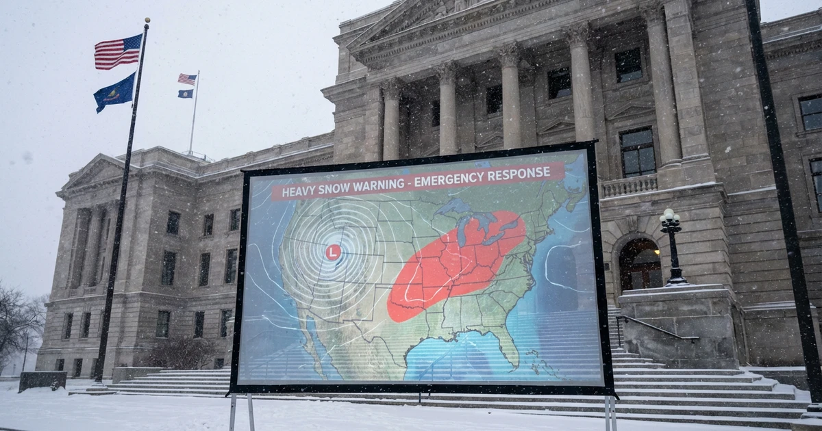
According to the latest meteorological models, the storm's trajectory places a wide swath of the country under threat of significant snowfall. The forecast maps, widely circulated by weather agencies and news outlets, display concentrated bands of snow stretching from the Midwest through the Northeast, with accumulations expected to be highest in regions already accustomed to harsh winter conditions.
- Key areas at risk include the northern Plains, Great Lakes region, and parts of the Northeast corridor.
- Some metropolitan centers within these zones could see travel delays, school closures, and disruptions to public services.
The maps serve as a crucial tool for both residents and emergency planners, providing visual clarity about where the most intense precipitation and hazardous travel conditions are likely to occur over the next 48 hours.
States Trigger Emergency Responses
In response to the forecast, 18 states have activated emergency protocols to address the anticipated impact. These measures range from pre-treating highways to opening emergency shelters and deploying snow removal resources in advance of the heaviest bands of precipitation. State and local officials are stressing the importance of preparedness, particularly for those living in rural or isolated areas where access to services could be limited during the storm's peak.
- Governors and local authorities have advised residents to monitor local updates, limit unnecessary travel, and stock up on essential supplies.
- Utility companies are on alert for potential outages caused by heavy, wet snow accumulating on power lines and trees.
Anticipated Impacts and Safety Tips
The storm's projected path means many communities will be dealing with snow totals that could disrupt daily life. Public safety officials are reminding people to take extra precautions:
- Allow extra time for travel and check real-time road conditions before heading out.
- Keep emergency kits in vehicles, including blankets, food, and water.
- Stay informed through official weather alerts and local news sources.
For up-to-date information on weather alerts and regional forecasts, residents can consult the National Weather Service and their state emergency management websites.
Looking Ahead: Continued Monitoring Essential
As the storm system continues its eastward march, meteorologists will update their predictions. The dynamic nature of winter weather means conditions can change rapidly; staying informed and heeding official warnings remains the best defense against potential hazards.
With emergency resources mobilized and communities on alert, the coming days will test the region's winter preparedness and resilience. Residents are urged to take the forecasts seriously and to act proactively to ensure safety for themselves and their neighbors as the storm unfolds.
Sources
- [1]CBS News